Bristol County Courthouse Complex
|
Bristol County Courthouse Complex | |
|
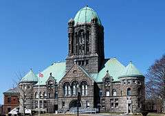
Superior Courthouse, 2008 | |
  | |
| Location |
9, 11, 15 Court St. Taunton, Massachusetts |
|---|---|
| Area | 13 acres (5 ha) |
| Built | 1826, 1894, 1904 |
| Architect | Frank Irving Cooper, Albion Marble |
| NRHP Reference # | 78000427 |
| Added to NRHP | March 28, 1978 |


The Bristol County Courthouse Complex Historic District contains three historic buildings located along Court Street in Taunton, Massachusetts, including the Bristol County Superior Courthouse, the Bristol County Registry of Deeds and the former First District Courthouse. The city’s Korean War and World War II Memorials are also located on the lawn in front of the superior courthouse. The Bristol County Courthouse Complex directly abuts the Taunton Green Historic District, the City's central square.[1]
In 2008, an $86 million expansion and renovation project began at the site which is scheduled to include the construction of a new trial court and restoration of the superior courthouse.[2]
Bristol County Superior Courthouse
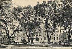
The Bristol County Superior Courthouse was designed by architect Frank Irving Cooper from nearby Bridgewater and built in 1894 in the Romanesque-style. The stone structure contains a 170-foot (52 m) tall central tower capped with a copper dome.[3] The building's large hip roof is also entirely clad in copper. The dome was originally topped with a large copper flame, which was taken down in the recent past for fear that it may fall. The flame is currently in storage, and the hope is that it will be restored as part of the construction project that began in 2008.
The superior courthouse is the fourth courthouse to be located on or near this site since 1747,[3] when Taunton became the shire town (county seat) for Bristol County, Massachusetts, after Bristol was split off from the Bay State and became part of Rhode Island.
Bristol County, Massachusetts also contains historic superior courthouses in Fall River and New Bedford.
Law Library
The district's law library is located in the upper floor dome section of the courthouse. It includes dozens of stacks of various law-related publications, including other library services.
War Memorials
Located on the front lawn of the superior courthouse are the city of Taunton's memorials to the World War II (installed in 1987) and the Korean War (installed in 1988).
Bristol County Registry of Deeds
The Bristol County Registry of Deeds is located at 11 Court Street, just north of the superior courthouse. It was built in 1904 and designed by architect Albion M. Marble of Fall River. It is constructed in brick and limestone in the Colonial Revival style. Together with a location in Attleboro, the Registry of Deeds contains all the property transaction records for the northern part of Bristol County, Massachusetts.[4]
Taunton District Courthouse
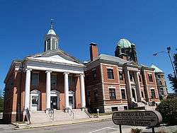
The former Taunton District Courthouse is a Greek Revival-style building located at 15 Court Street. It was originally constructed in 1826 as the county courthouse at the site of the current superior courthouse, but moved to its current location in the 1890s. Constructed in red brick, the building features a white wooden portico and copper-capped cupola on the roof.
The building has been plagued by water leakage and other structural problems, and also does not meet current ADA regulations which led to the district court business to be moved to a temporary location in the city of Taunton.
Temporary location
The Taunton District Courthouse is currently located in a temporary location in the city’s former century-old Cohannet Middle School building on Cohannet Street. It will serve as the city’s trial court until a new permanent location is completed on a location northeast of the current superior courthouse, with access from Broadway.
See also
References
- ↑ Bristol Superior Court
- ↑ Taunton Gazette, March 24, 2008 Archived July 16, 2011, at the Wayback Machine.
- 1 2 Walking Tours Taunton, Massachusetts; a guide to historic properties, 1998
- ↑ Registry of Deeds, Taunton
External links
- Mass.Gov: Bristol Probate and Family Court
- Mass.Gov: Bristol Superior Court
- Mass.Gov: Taunton District Court
- Frank Irving Cooper, Architect May 8, 1867 - Oct 21, 1933
- Architects Listing with Frank Irving Cooper and Biography Listed
Coordinates: 41°54′52″N 71°05′33″W / 41.9145°N 71.0925°W

