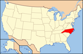
Boylan Heights (Raleigh, North Carolina)
|
Boylan Heights | |
|
Bungalow typical of smaller homes in the district | |
  | |
| Location | Roughly bounded by Norfolk & Southern RR, Mountford, Martin and Florence Sts. and Dorothea Dr., Raleigh, North Carolina |
|---|---|
| Coordinates | 35°46′26″N 78°39′7″W / 35.77389°N 78.65194°WCoordinates: 35°46′26″N 78°39′7″W / 35.77389°N 78.65194°W |
| Area | 82 acres (33 ha) |
| Built | 1907 |
| Architect | Multiple |
| Architectural style | Bungalow/Craftsman, Colonial, Queen Anne |
| MPS | Early Twentieth Century Raleigh Neighborhoods TR |
| NRHP Reference # | 85001671[1] |
| Added to NRHP | July 29, 1985 |
Boylan Heights is a historic neighborhood in Raleigh, North Carolina. It was added to the National Register of Historic Places as a historic district on July 29, 1985. It is also one of six local Historic Overlay Districts in Raleigh.
Boylan Heights has been explored in the book Everything Sings: Maps for a Narrative Atlas by resident and critical cartographer Denis Wood, which maps the neighborhood in unusual ways. In the introduction to the book, Wood writes that these maps explore "other ways of thinking about [Boylan Heights] . . . as some sort of community, or as a marriage of community and place, or as those people in that place, their relationships, and their ways in the world . . . a life process." Maps include the location of jack-o'-lanterns on porches, radio waves permeating the air, the light from street lamps, and other attributes of Boylan Heights that cannot be mapped in a traditional way.[2]
The national historic district encompasses 252 contributing buildings and was developed between about 1907 and 1935. It includes notable examples of Queen Anne, Colonial Revival, and Bungalow / American Craftsman style architecture.[3]
Its name was used for the 1987 album Boylan Heights by The Connells. There is a restaurant named after the district in the The Corner neighborhood of Charlottesville, Virginia.
Notable structures
- Montfort Hall, built for William Montfort Boylan in 1858
Notable residents
- Denis Wood, widely reviewed former NCSU professor of Design
- Charles Meeker, former mayor of Raleigh, NC
- Deborah K. Ross, former member of the NC General Assembly and former manager of the ACLU in NC
See also
References
- ↑ National Park Service (2010-07-09). "National Register Information System". National Register of Historic Places. National Park Service.
- ↑ Wood, Denis (2013). Everything Sings: Maps for a Narrative Atlas. Los Angeles: Siglio Press. ISBN 978-1-938221-02-6.
- ↑ unknown (n.d.). "Boylan Heights" (pdf). National Register of Historic Places - Nomination and Inventory. North Carolina State Historic Preservation Office. Retrieved 2015-06-01.
External links
- Boylan Heights neighborhood web page
- Travel itinerary page at NPS.gov
- National Register Historic Districts in Raleigh, North Carolina, RHDC
- Boylan Heights Historic Overlay District, RHDC


