Booderee National Park and Botanic Gardens
| Booderee National Park Jervis Bay Territory | |
|---|---|
|
IUCN category II (national park) | |
 Booderee National Park | |
| Nearest town or city | Sussex Inlet |
| Coordinates | 35°09′03″S 150°38′43″E / 35.15083°S 150.64528°ECoordinates: 35°09′03″S 150°38′43″E / 35.15083°S 150.64528°E |
| Established | 1992 |
| Area | 63.12 km2 (24.4 sq mi) |
| Managing authorities |
Director of National Parks Wreck Bay Aboriginal community |
| Website | Booderee National Park |
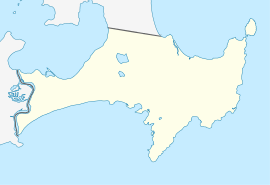
Booderee National Park and Botanic Gardens are located in the Jervis Bay Territory of Australia. The reserve is composed of two sections:
- the Bherwerre Peninsula, on the southern foreshore of Jervis Bay, Bowen Island and the waters of the south of the bay
- lands bordered by Wreck Bay to the south, St Georges Basin to the north and Sussex Inlet to the west
What is now the national park was declared as a nature reserve in 1971. In 1992, Jervis Bay National Park was declared. Although the local Aboriginal community was offered two seats on the park's Board of Management, the offer was declined as part of a protest over land rights issues.
In 1995, the park was transferred to the Wreck Bay Aboriginal community, which leases the area back to the Australian Department of the Environment and Heritage. At this time, the name of the park was changed to "Booderee". The name, meaning 'bay of plenty' or 'plenty of fish' in the Dhurga language, was chosen by the local Aboriginal community.
Park highlights

With its unspoiled beaches and abundant flora and fauna, the park, located just three hours from the cities of Sydney and Canberra, is extremely popular with tourists.
The park’s sea cliffs are the highest in New South Wales and among the highest anywhere on the east coast of Australia, peaking at Steamers Head which rises to 130 m.[1]
The Cape St George Lighthouse ruin is considered the most significant European heritage site in the park and was listed on the Register of the National Estate in 1981.
The beach at Greenpatch is a popular destination, and is said to have the whitest sand in the world.[2] In addition there are abundant surf breaks on the ocean sides of the Park, most notably South Coast Pipe.
Although not accessible to the public, a little penguin rookery exists on Bowen Island.
Murrays beach lies just to the west of the southern headland, facing Bowen Island and is one of the most beautiful in the park.
.jpg)

References
- ↑ Lindenmayer, David; MacGregor, Christopher; Dexter, Nick; Fortescue, Martin (2014). Booderee National Park. CSIRO Publishing. ISBN 9781486300426.
- ↑ Gazing onto the world's whitest sand, SMH, 31 December 2005.