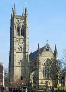
Bolton Town Hall

Bolton Town Hall facing Victoria Square in Bolton, Greater Manchester, England, was built between 1866 and 1873 for the County Borough of Bolton to designs by William Hill of Leeds and George Woodhouse of Bolton. The town hall was extended in the 1930s to the designs of Bradshaw, Gass and Hope and has been designated a Grade II* listed building by English Heritage.[1]
Background
The town hall was promoted by the mayor, J.R. Wolfendon, in the early 1860s. The cost was expected to be between £70000 and £80,000 but more than doubled to £167,000,[2] equivalent to £13,340,000 in 2016.[3] Bolton Corporation held a competition for a new town hall design in the 1860s. It was won by a pupil of Cuthbert Brodrick, architect William Hill from Leeds whose design was very similar to that of the 1858 Leeds Town Hall.[4] It was opened in June 1873 by Albert Edward, Prince of Wales. Portsmouth Guildhall, also designed by Hill in 1890, is a similar, slightly larger copy of the town hall.[5]
In the early 1930s the town hall was extended and a crescent of civic buildings was built to the rear on a new street to provide office space. The extension matches the Victorian building externally, but is plain inside and contains offices.[6]
In 1978 Fred Dibnah made repairs to the clock tower and its 16 stone pillars. Whilst repairing the tower he gilded the sphere at the top.[7]
During the cold war, the county standby nuclear bunker was located directly below the town hall. This dates back to the second world war and would have been modernised to offer protection from nuclear attack. [8]
Architecture
The original building on a rectangular plan is designed in the neoclassical style in the form of a temple with a tall baroque-style clocktower. The town hall has a high basement storey and two principal floors above in sandstone ashlar which is rusticated at basement level. It has a broad flight of steps up to a five-bay portico with a pediment in which there is a high-relief sculpture by William Calder Marshall. Either side of the entrance are five-bay ranges of two storeys with round-arched windows to the first floor. A quarter-chiming clock by Potts of Leeds was installed in the tower in 1871.[9]
The town hall had a central hall lit by a clerestory that was damaged by fire in November 1981. In the reconstruction it was rebuilt as two public halls, the Albert Hall and Festival Hall. The halls are surrounded by an outer ring of offices. There were two identical buildings erected to the same plans.
Civic Centre

The Civic Centre on Le Mans Crescent, housing the museum, library, health clinics, and courts, was built in 1932–39 to the designs of Bradshaw Gass and Hope. Its plan is slightly asymmetric with end pavilions flanking a shallow crescent. There was previously a police station within the northern half of the building adjacent to the Magistrate's Court. This has been converted to offices although the former cells are still used for holding those facing transfer to prison or awaiting appearances before the court. The building has a steel frame faced in sandstone ashlar with parapets and a slate roof. It has three central arches accessing Cheadle Square. The Civic Buildings are Grade II listed.[10]
References
Notes
- ↑ Historic England, "Town Hall (1388295)", National Heritage List for England, retrieved 12 September 2012
- ↑ Cunningham 1981, pp. 70–71.
- ↑ UK CPI inflation numbers based on data available from Gregory Clark (2016), "The Annual RPI and Average Earnings for Britain, 1209 to Present (New Series)" MeasuringWorth.
- ↑ Cunningham 1981, p. 43.
- ↑ Portsmouth Guildhall, portsmouthguildhall.org.uk/, retrieved 29 March 2016
- ↑ Town Hall Conservation Area (pdf), bolton.gov.uk, pp. 7–9, retrieved 1 April 2012
- ↑ Hall 2006, pp. 99–101.
- ↑ https://books.google.co.uk/books?id=DhzOAwAAQBAJ&pg=PA221&dq=bolton+townhall+bunker&hl=en&sa=X&ved=0ahUKEwjJgv-OhtjQAhWrD8AKHSypAGgQ6AEIHTAA#v=onepage&q=bolton%20townhall%20bunker&f=false
- ↑ Potts 2006, p. 378
- ↑ Historic England, "Civic Centre (1352691)", National Heritage List for England, retrieved 7 April 2012
Bibliography
External links
Coordinates: 53°34′41″N 2°25′48″W / 53.578°N 2.430°W

