Betna
| Betna | |
|---|---|
| Village | |
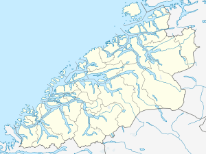 Betna 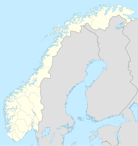 Betna Location in Møre og Romsdal | |
| Coordinates: 63°5′15.680″N 8°21′10.336″E / 63.08768889°N 8.35287111°ECoordinates: 63°5′15.680″N 8°21′10.336″E / 63.08768889°N 8.35287111°E | |
| Country | Norway |
| Region | Western Norway |
| County | Møre og Romsdal |
| District | Nordmøre |
| Municipality | Halsa Municipality |
| Elevation[1] | 40 m (130 ft) |
| Time zone | CET (UTC+01:00) |
| • Summer (DST) | CEST (UTC+02:00) |
| Post Code | 6683 Vågland |
Betna is a village in the municipality of Halsa in Møre og Romsdal county, Norway. It is part of the Nordmøre region. It lies at the southeast end of the Skålvik Fjord (Skålvikfjord),[2] where the Betna River (Betnelva) empties into Betna Bay (Betnvågen). The name Betna is derived from the verb beite 'to graze'.[3] The Blekken Elementary School is located in Betna.[4] There used to be a convenience store in the settlement, but it went out of business in 2004. Traces of an Iron Age settlement were discovered in Betna during roadwork on the junction of European route E39 with County Road 65. The Museum of Natural History and Archaeology in Trondheim carried out archaeological investigations at the site in the summer of 2006.[5]
References
- ↑ "Betna, Halsa (Møre og Romsdal)" (in Norwegian). yr.no. Retrieved October 24, 2015.
- ↑ Touren-Wegweiser für Radfahren und Wandern.
- ↑ Analyse av stadnamna. Archived October 30, 2015, at the Wayback Machine.
- ↑ Møre og Romsdal fylkeskommune: Blekken barneskule.
- ↑ Utgraving på Betna på Nord-Møre.