Bailey Colony Farm
|
Bailey Colony Farm | |
 | |
 | |
| Location | 3150 N. Glenn Highway |
|---|---|
| Nearest city | Palmer, Alaska |
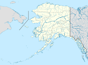
| Coordinates | 61°36′59″N 149°7′2″W / 61.61639°N 149.11722°WCoordinates: 61°36′59″N 149°7′2″W / 61.61639°N 149.11722°W |
| Area | 2 acres (0.81 ha) |
| Built | 1935; 1940 |
| Built by | Bailey,Ferber |
| Architect | Williams,David |
| MPS | Settlement and Economic Development of Alaska's Matanuska-Susitna Valley MPS |
| NRHP Reference # | 91000775[1] |
| Added to NRHP | June 21, 1991 |
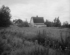
The Bailey Colony Farm, on the Glenn Highway near Palmer, Alaska in Matanuska-Susitna Borough, is a historic Matanuska Colony farmstead that dates from 1935. It was part of a New Deal program opening farms in Alaska as part of assisting overpopulated rural areas of the lower 48 states of the USA, in a program conceived of by FERA architect David Williams.
Also known as the Estelle Farm and denoted as AHRS Site No. ANC-056, the Bailey Colony Farm was listed on the National Register of Historic Places in 1991. The listing included two contributing buildings.[1][2] It was the home of Ferber and Ruth Bailey and their children, who were colonists from Wisconsin. The house is a 28-by-32-foot (8.5 m × 9.8 m) one-and-a-half story building with a gambrel roof; the barn is a 32-by-32-foot (9.8 m × 9.8 m) log and frame built building also with a gambrel roof. Both were built in 1935. The barn was moved about 150 feet in the 1940s to its present location, when the Glenn Highway was widened.[2]
See also
- Matanuska Valley Colony
- National Register of Historic Places listings in Matanuska-Susitna Borough, Alaska
References
- 1 2 National Park Service (2010-07-09). "National Register Information System". National Register of Historic Places. National Park Service.
- 1 2 "National Register of Historic Places Inventory/Nomination: Bailey Colony Farm / Estelle Farm / AHRS Site No. ANC-056" (PDF). National Park Service. and accompanying six photos