Baharagora
| Baharagora बहड़ागुड़ा (बहरागोड़ा) | |
|---|---|
| town | |
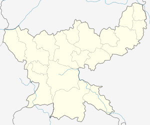 Baharagora  Baharagora Location in Jharkhand, India | |
| Coordinates: 22°17′N 86°43′E / 22.28°N 86.72°ECoordinates: 22°17′N 86°43′E / 22.28°N 86.72°E | |
| Country |
|
| State | Jharkhand |
| District | East Singhbhum |
| Area | |
| • Total | 433.331 km2 (167.310 sq mi) |
| Elevation | 79 m (259 ft) |
| Population (2001) | |
| • Total | 149,000 |
| • Density | 340/km2 (890/sq mi) |
| Languages | |
| • Official | Hindi, Santali, Bengali, Odia |
| Time zone | IST (UTC+5:30) |
| PIN | 832101 |
| Telephone code | 91-6594 |
| Vehicle registration | JH 05 |
Baharagora (Some time people spell it wrong as in devnagri (वेहरागोड़ा, बहरागोडा) but as per LOCAL it correct spelling in devnagri बहड़ागुड़ा)is a small town in East Singhbhum district and situated on the south-east corner of Jharkhand, India. It is approx. 100 km from Jamshedpur & 200 km from Kolkata. Baharagora is a very important hub for transport as National Highway 6/Asian Highway 46 passes through here and almost all the Transport Companies have their transit hub here. National Highway 33 connects NH 6 at Baharagora and NH 2 at Barhi, Jharkhand.
Nearest Railway Station Chakulia 30.6 km, Jhargram 50 km & Kharagpur 70 km & Kolkata(Howrah)189 km
Baharagora became a block in the year 1956. It is located at the southern end of Jharkhand.
Baharagora is the entry point of Jharkhand from the two states, namely West Bengal and Odisha. Since it is located at the border, West Bengal is approx 12 km and Odisha is approx 7 km from there. Although the official language of the state is Hindi, the local language in the area is a blend of Bengali and Odia. Except some government employees, all localities use either Bengali or Odia as primary mode of education. Although people are switching to Hindi or English as their primary mode of education. In the erstwhile state of Bihar, textbooks were also released in Bengali and Odia.
It came into headlines of Google when a 13-year-old boy 'Saikat Ghosh' became the regional finalist of 'Google Science Fair 2014' securing a position in the National FINAL with his Perpetual Motion Electricity Generator Concept.
Temples,Mosque
Temples
- Chitreshwer Shiv Mandir - 12 km.
| Baharagora | |
|---|---|
 Chitreshwar Shiv Mandir |
- Netaji Subhash Park --0 KM
- Panchbariya Shiv Mandir - 15 km.
- Hanuman Mandir, Rasikpur(Baharagora)
- Ghaspada krishna mandir - 16 km.
- Kumardubi Shiv Mandir, krishna mandir - 16 km.
- Patrasuni Mandir,Khamar - 11 km.
- Shitala Mata Mandir-1.5 km.
- Saljhatia Shiv Mandir - 9 km.
- Shiva mandir (Sandra)- 9.5 km
- Manusmuria Jaiguru Sanstha - 15 km.
- Jagannatha Mandir - 2 km.
- Shiva Mandir (hatchala) - 2 km.
- Guhiyapal Shiva Mandir
- Sri Sri Rasik Jeevan Mandir(Benda)- 5 km. from Baharagora
- Sri Hotteshwar Shiv Mandir(Benda)- 5 km. from Bahragora
- Shiv Mandir Jugalsalbni
- Maa Swargabauri Mandir Kesharda
- Shiv Mandir Kesharda
- Bada Parulia Shiv Mandir, 13 km From Baharagora
- Choto Parulia Radha Kishan Mandir, 12 km from Baharagora
- Gopal Mandir, Makri- 12 km from Baharagora
- Maa Dar basini Mandir Jugalsalboni
- Maa Kali Mandir (Kali Badi)- 0 km.
- Bhuteshwar shiv mandir -Khandamouda. from Baharagora
- Paharpur Shiv Mandir, Dungri(Kaparia)
- sri sri kameswar mandir(mahuldangri).it is south in Baharagora.
- Jaypura Shiv Mandir, (jaupura)
- Chandra Shiv Mandir & Krishna Mandir.-13 Km.from Baharagora.
- Chandra Kalamahagan Than. and Kali Mandir.13 Km.from Baharagora.
- Patharghata Shiv Mandir.12Km. from Baharagora.
- Bhairab Mandir, Keshorda
Mosque
- jama masjid
.
Geography
Baharagora is located at 22°17′N 86°43′E / 22.28°N 86.72°E.[1] Baharagora Krishi Mela [2] It has an average elevation of 79 m (259 ft). The river Subarnarekha flows along its adjoining areas (approx at a distance of 7 km).
Education
Schools
- 1. Baharagora High School, Baharagora
- 2. T.P.S. D.A.V. Public School, Baharagora
| Baharagora | |
|---|---|
 TPS DAV Public School, Baharagora |
- 3. Saraswati Shishu Vidya Mandir, Baharagora
- 4. Projects Girls High School, Baharagora
- 5. Ramakrishna Vivekananda International English School, Baharagora and Matihana
- 6. Jawahar Navodaya Vidyalaya, Balikuria
- 7. Kasturba Gandhi Balika Vidyalaya, Baharagora
Apart from these many primary schools, middle schools and high schools are present in Baharagora block
- 8. Lal Bahadur Sastri (L.B.S) High School, Jaypura
- 9. Choto Parulia High School.
- 10. Azambar Shaw High School, Muchiasai.
- 11. Chandra Upgration Middle School.
- 12. kumardubi Darkhuli high school , Kumardubi
- 13. Keshorda High School, Keshorda
Colleges
- 1.Baharagora College,Baharagora
| Baharagora | |
|---|---|
 State Bank of India, Baharagora |
Banks in Baharagora & around
- Central Bank of India, Baharagora, (IFSC: CBIN0281059) [3]
- Central Bank of India, Matihana, (IFSC: CBIN0283035)
- Canara Bank, Sakra (IFSC: CNRB0004618)
- Canara Bank, Gamaria (IFSC: CNRB0001725)
- Bank of India, Guhiyapal, (IFSC: BKID0004549)
- Punjab National Bank, Jagannathpur (IFSC: PUNB0167400)
- Punjab National Bank, Darisol (IFSC: PUNB0269000)
- State Bank of India, Baharagora (IFSC: SBIN0005110)
- Jharkhand Gramin Bank
- Singhbhum District Central Cooperative Bank Ltd.
Places to See
- Netaji Subhash Children Park
- Jyoti Pahari
- Kapariya Dungri
- Subarnarekha River
- Balia Baba Ashram
- Binapani Stadium
- Chakulia Airport
References
- ↑ Falling Rain Genomics, Inc - Baharagora
- ↑ baharagora.com
- ↑ "Central Bank of India Bahargora IFSC Code". Retrieved 2015-06-26.