Aston
| Aston | |
 Aston |
|
| Population | 32,286 (2011.Ward)[1] |
|---|---|
| – density | 10,833 mile² (4,185 km²) |
| OS grid reference | SP072889 |
| Metropolitan borough | City of Birmingham |
| Metropolitan county | West Midlands |
| Region | West Midlands |
| Country | England |
| Sovereign state | United Kingdom |
| Post town | BIRMINGHAM |
| Postcode district | B6 |
| Police | West Midlands |
| Fire | West Midlands |
| Ambulance | West Midlands |
| EU Parliament | West Midlands |
| UK Parliament | Birmingham Perry Barr |
|
|
Coordinates: 52°30′N 1°53′W / 52.50°N 1.88°W
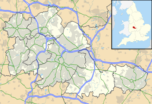
Aston is an area in Central Birmingham, in the West Midlands of England. Commencing immediately to the north-east of the city centre, Aston constitutes a ward within the unitary authority.
History
Aston was first mentioned in the Domesday Book in 1086 as "Estone", having a mill, a priest and therefore probably a church, woodland and ploughland. The Church of SS Peter & Paul, Aston was built in medieval times to replace an earlier church. The body of the church was rebuilt by J. A. Chatwin during the period 1879 to 1890; the 15th century tower and spire, which was partly rebuilt in 1776, being the only survivors of the medieval building.
The ancient parish of Aston (known as Aston juxta Birmingham) was large. It was separated from the parish of Birmingham by AB Row, which currently exists in the Eastside of the city at just 50 yards in length. It was partly included in the borough of Birmingham in 1838, and a further part, Saltley was added in 1891.
Old buildings which became popular within Aston included the Aston Hippodrome and the Bartons Arms public house. Gospel Hall on Park Lane was opened in 1892 and demolished in the 1970s to be rebuilt at the top of Park Lane in 1979. The original hall had a seating capacity of 73. Another meeting place was the Ellen Knox Memorial Hall which was next door to the Midland Vinegar Brewery. The brewery was owned by the Midland Brewery Company was built around 1877.[2] It was located on Upper Thomas Street. The brewery was a three storey brick building with rounded corners and semi-circular windows. The roof was slated. Other industry that was located in Aston include the Premier Motor Works which produced cars during the early 20th century. The works were situated at the junction of Aston Road and Dartmouth Street. On Miller Street was a tramcar depot which had a storage capacity of 104 tramcars. It opened in 1904.[3]

Aston underwent large scale redevelopment following the Second World War. South Aston was designated a renewal area whilst a new town to the west of this.[4] This became "Newtown" and is a large estate consisting of sixteen tower blocks, five of which have since been demolished. The project was approved in 1968. Three 20 storey tower blocks on the complex contained 354 flats alone.[5]

Today, Aston is famous for Aston Villa F.C. and Aston University (the campus of which is not in Aston but actually located to the far south of Aston in Birmingham city centre). Aston University is one of four universities in Birmingham. Aston Villa have played at Villa Park since 1897, and it has traditionally been one of the largest football grounds in England that has staged many notable matches at club and international level. The park has also hosted other sports and events including international level rugby league and rugby union.
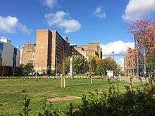
Much of Aston consists of terraced houses that were built around the end of the 19th century and the beginning of the 20th century. Some of these houses were demolished in the late 1960s to make way for the Aston Expressway, which links Birmingham city centre to the M6 motorway. In the late 1950s, Aston was the location of the famous 'Venus Baby' case of Cynthia Appleton (87 Fentham Road).
By the early 1980s, Aston was suffering from severe deprivation with many of the terraced houses being outdated for the requirements of the time. Many of them lacked bathrooms and indoor toilets, whilst the vast majority were suffering from decay as a result of a lack of maintenance. There was speculation that the homes would be demolished, but Birmingham City Council made money available to the homeowners for them to be brought up to modern standards.
Crime
The crime rate is higher than the city average and higher than the UK average, and many high profile incidents have been reported in national news outlets. On 2 January 2003, gunmen shot at three innocent teenage girls who were celebrating the New Year in the [Birchfield] area of Aston. Two of the girls were killed and another was seriously injured. More than 18 bullets were fired from at least two weapons.[6] Four men were later tried and found guilty of murder in March 2005. Marcus Ellis (the half-brother of one of the two dead girls), Nathan Martin and Michael Gregory were sentenced to life imprisonment with recommended minimum terms of 35 years on two charges of murder and three of attempted murder. A fourth man, Rodrigo Simms, received life with a recommended minimum of 27 years for the same crimes.[7] A fifth defendant, Jermaine Carty, had walked free from court after being cleared of possessing a firearm.[8] The four men convicted were members of a notorious local gang known as the Burger Bar Boys, who had been trying to gain revenge on members of their rival gang the Johnson Crew - a notorious local gang with roots stretching back to the mid-1980s.[9]
Politics
The Aston ward is represented by three Labour councillors.[10]
Aston has adopted a Ward Support Officer with the current holder of the title being Pat Whyte.
Demographics
The 2001 Population Census found that 27,917 people were living in Aston with a population density of 4,185 people per km² compared with 3,649 people per km² for Birmingham. 50.4% of the population was female and 49.6% was male. This was above and below the national and city average respectively.
Aston has an area of 6.4 km²/ 451.5 hectares. Aston is a very diverse community, ethnically, with 70.6% (19,030) of the area's population being of an ethnic minority compared with 29.6% for Birmingham. 36.9% of the population was born outside the United Kingdom, over double the city average of 16.5% and nearly four times the national average of 9.3%. The largest ethnic group was Asian at 49.8%. More specifically, the Pakistani ethnic group was the largest at 27.2%. White British was the second largest ethnic group at 26.00% and Black British was third with 21.51%. The smallest broad ethnic group was Chinese and Other at 2.2%, double the city average of 1.1%. Islam was the most prominent religion in the ward with 44.3% of the ward's population stating themselves as Muslim. Christianity was the second most prominent religion in Aston at 32.4%.
The ethnic make-up of the area drastically changed in the 1950s and 1960s with immigration from the Commonwealth. Most of the immigrants were from the Indian subcontinent, though a significant number were from the Caribbean.
_Aston_Expressway.jpg)
A total 99% of the residents lived in households, above the city average of 98.3% and the national average of 98.2%. 1% lived in communal establishments. There was a total of 9,939 occupied households in Aston at the time of the census resulting in an average of 2.8 people per household, above the city average of 2.5 and the national average of 2.4. 37.7% of households were owner occupied, below the city average of 60.4%. 33.5% of households were rented from Birmingham City Council, above the city average of 19.4%. 454 households were stated as being vacant. 41.7% of the total households were stated as terraced, above the city average of 31.3%. 28.2% of households were stated as purpose built blocks of flats, just over double the national average of 14%.
11.6% of the population was of a pensionable age, below the city average of 16.7% and the national average of 18.4%. 57.7% were of a working age, below both the city and national average. The largest age group in the ward was 25-44 at 28.1%, compared with the city average of 28.3%. This age group is also the largest for Birmingham and the country.
46.7% of the residents were in full-time employment, below the city average of 59.9% and the national average of 61%. At 20.6%, Aston had an above average unemployment rate with the city average being 9.5% and the national average 5%. 35% were in long term unemployment, below the city average of 36.3% but above the national average of 30.3%. 20.2% had never worked. The manufacturing industry provided the most employment to the ward at 18.2%.
Education
There are three secondary schools in Aston: Broadway School (Broadway also has a campus in Perry Barr), King Edward VI Aston and Aston Manor School. There are seven primary schools: Aston Tower Community Primary School, Birchfield Community School, Lozells Junior & Infant & Nursery School, Manor Park Primary School, Mansfield Green Community School, Sacred Heart Cathlolic Primary School, Prince Albert Junior and Infant School and Yew Tree Community School. Aston is currently served by Aston Library though the Library may be cut, Birmingham City Council blames lack of funding from the Central government.[11]
Aston Cross
Aston Cross was once the home of Ansells Brewery and HP Sauce. The six-acre Aston site was purchased by developer Chancerygate in 2007 at £800,000 per acre, but they subsequently sold it for half that price and it now houses a distribution warehouse for East End Foods. There is a campus of City College, Birmingham there. Aston Manor Brewery was started in Thimblemill Lane in 1982 by former employees of Ansell's after Ansell's Aston Brewery closed.
From 1956 to 1969, Aston Cross was the Midlands base of television broadcaster ATV which had its Alpha Studios on Aston Road North. The ATV office building later became the studios of radio stations BRMB and XTRA-AM. Although both stations moved to Birmingham's Broad Street in the early 1990s, the building is still called Radio House. Launching in February 1974, BRMB was the UK's fourth commercial radio station and, while in Aston, was the most listened to station in the West Midlands.
Places of interest
- Aston Expressway
- Aston Hall
- Aston University
- Aston Villa Football Club and Villa Park
- Aston Reservoir
- Spaghetti Junction
- King Edward VI Aston
- Former Norton motorcycle factory
- Church of SS Peter & Paul, Aston
Notable residents
- All the original members of the heavy metal band Black Sabbath were born and raised in the Aston area: Ozzy Osbourne, Tony Iommi, Bill Ward and Geezer Butler.
- Victor Johnson, (1883–1951) was a track cycling racer, who in 1908, won a gold medal at the Olympics, became 'World Amateur Sprint Champion' and the 'British National Quarter-mile Champion'.
- The author Sir Arthur Conan Doyle worked in the area for a short period.
- John Benjamin Stone, a politician and prolific photographer, was born in Aston and took over his father's glass manufacturing business in the area upon his death.
- Albert Ketèlbey, composer, conductor and pianist, was born in Aston on August 9, 1875.
- Anthony "TJ" Wall, member of the Sutton 495 Air Cadets was born here on July 17, 1997.
- R&B singer Jamelia lived for a short period in Aston.
- Leicester City F.C. winger Lloyd Dyer was born in Aston and Gustard was also a resident.
See also
References
- ↑ "Birmingham Ward population 2011". Retrieved 14 December 2015.
- ↑ Douglas Hickman (1970). Birmingham. Studio Vista Limited. p. 40.
- ↑ Astonbrook through Astonmanor: Aston Development Archived September 27, 2007, at the Wayback Machine.
- ↑ BGFL: Redevelopment and Renewal
- ↑ Emporis: Newtown, Birmingham Archived September 30, 2007, at the Wayback Machine.
- ↑ "Gunmen fired more than 30 shots". BBC News. 2003-01-03. Retrieved 2008-08-01.
- ↑ Parker, Andrew (2007-05-21). "Burger Bar killers jailed". The Sun. London.
- ↑ "Four jailed for New Year killings". BBC News. 2005-03-21.
- ↑ "Background: How the Burger Bar Boys and the Johnson crew came to the fore". Birmingham Mail.
- ↑ "Birmingham City Council - Councillors by ward".
- ↑ Four Birmingham libraries facing closure because of budget cuts
- The City of Birmingham Baths Department 1851 - 1951, J. Moth, 1951
- 2001 Population Census information: Ward profiles
External links
- Birmingham City Council: Aston Ward
- Aston Library
- Aston History
- The History Of Aston by Aston People
- Profile: Aston Birmingham


