Asadabad, Afghanistan
| Asadabad اسدآباد Chagha Saray | |
|---|---|
|
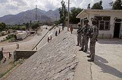
US soldiers in Asadabad (August 2009) | |
| Nickname(s): Abad - US soldiers use it referencing Asadabad and nearby FOB | |
 Asadabad Location in Afghanistan | |
| Coordinates: 34°52′27″N 71°9′10″E / 34.87417°N 71.15278°ECoordinates: 34°52′27″N 71°9′10″E / 34.87417°N 71.15278°E | |
| Country |
|
| Province | Kunar Province |
| District | Asadabad District |
| Government | |
| • Type | Islamic republic |
| Elevation | 827 m (2,713 ft) |
| Population [1] | |
| • Total | 48,400 |
| Time zone | + 4.30 |
Asadabad or Asad Abad (Pashto: اسدآباد - Asadābād, Persian: اسدآباد) is the capital city of Kunar Province in Afghanistan. It is located in the eastern portion of the country adjacent to Pakistan. The city is located within a valley at the confluence of the Pech River and Kunar River between two mountain ridgelines running along both sides of the valley from Northeast to Southwest.
Asadabad is in a mountainous region of the Hindu Kush mountains about 13 km (eight miles) northwest of the Pakistani border and 80 km (50 miles) northeast of Jalalabad, Afghanistan. Asadabad deals with a moderate amount of trade goods. Nawa Pass, that lies about 16 km (10 miles) south of Asadabad, is the next major border crossing point north of the Khyber Pass for the region.[2] The pass is under constant observation due to its relative ease to cross for commerce and its potential usage for smuggling and Taliban insurgents.[3]
History
The surrounding Kunar Province lies near the historic routes connecting Central Asia, India, and Iran, such as the Silk Road and the Grand Trunk Road through the Khyber Pass, as well as routes through the Hindu Kush mountains. Asadabad lies at the confluence of the two major rivers of the area, the Kunar and the Pech. The region would have come under the borders of various empires of the ages, including the Achaemenid Persians, the Greco-Bactrian Kingdom, etc. It was very close to the paths Alexander the Great passed by on his way from conquering Persia to invading India. Asadabad is also on the eastern boundary of what was Kafiristan - part of Afghanistan not converted to Islam until the 1890s.[4]
In the past, the area near Asadabad was called Chaga Serai, with various spellings (Chega Serai, Chagasaray, Chigur Serai, Chughansuraee).[5][6][7][8][9]
Emperor Babur (late 15th century/early 16th century) claims to have taken over the town as part of his military campaigns in the area. He describes it very briefly in his book, Baburnama. He also mentions relations with the Kaffirs, whom he claims helped defend the town against him.[10]
In the late 19th century/early 20th century the capital of the region was moved from Pushoot/Pasat/Pasad to the present Asadabad location. Over the 20th century, various technical improvements were made such as roads, a shopping area, schools, a bridge, a gas station, etc.[11]
In the opening times of the Soviet Afghan war (1979-1988), Kunar province saw some of the first rebellions against the communist People's Democratic Party of Afghanistan. As punishment, PDPA troops with Soviet advisors massacred the males of the nearby village of Kerala, burying their bodies in a field near the Pech river.[12] Asadabad was later linked to a Soviet military base during the war, which included Spetsnaz.[13] Several Russian websites, like http://asadabad.ru, contain discussions and photos regarding this era.
The rebel Mujahideen later took over the town from the Soviets. Gulbuddin Hekmatyar's Hizb-e-Islami, one of the Peshawar Seven groups, had heavy influence in the area. Osama bin Laden also spent time in Asadabad.[14]
Modern day
About 10% - 15% of the valley surrounding Asadabad is used for agriculture by using an ancient land development technique called terracing. However, flooding and erosion have been an issue in the past. The primary crops are wheat, rice, sugarcane and vegetables. Multiple international agencies are assisting with these issues and other issues throughout the province.
In January 1979, a large guerrilla force, reported by the contemporary press - estimated - at 5,000 strong, attempted to capture the town, which was the headquarters of the Afghan Army's 9th Division.[15]
In 1985, in the Battle of Maravar Pass the Afghan Mujahideen killed 31 Soviet troops in an ambush.
On 20 April 1991, the marketplace of Asadabad was hit by two Scud missiles, that killed 300 and wounded 500 inhabitants. Though the exact toll is unknown, these attacks resulted in heavy civilian casualties.[16] The explosions destroyed the headquarters of Islamic leader Jamil al-Rahman, and killed a number of his followers.[17]
In 2001 the War on Terror began with the invasion of Afghanistan, including Kunar Province. Forward Operating Base Camp Wright was set up a few miles south of Asadabad. According to an Army article, the camp was originally built by the Soviets.[18]
As of January 2009, growth around Asadabad has been substantial. Examples of development are:
- Kunar province's main marketplace now has more than 600 stores, up from 100 just three years ago.
- Provincial Reconstruction Teams (PRTs) have constructed 16 schools, 20 medical clinics, and 8 district centers.
- PRTs completed construction on 13 roads and 11 bridges.
- Agribusiness Developmental Teams (ADTs) have several evolving projects and over 10 demonstration farms.
- Jalalabad-Asmar and Pech River roads have cut travel times in half and connected Asadabad centers of commerce with Jalabad.[19]
The Afghan National Police provide security for the city and district. There is also the International Security Assistance Force (ISAF), led by the United States armed forces. It is not only helping the Afghan government to develop the area but is also training the Afghan National Security Forces (ANSF), including the Afghan Border Police and the Afghan Armed Forces.
Notable residents and incidents
- Asadabad is the birthplace of Jamal-al-Din Afghani.[20] The town hall in Asadabad is named after him.[21]
- U.S. Navy Lieutenant Michael P. Murphy was posthumously awarded the Medal of Honor for his actions during Operation Red Wings, which took place in the mountainous terrain near Asadabad from June to July 2005.
- US Operations: "Big East Wind" and Operation Mountain Lion[22]
- A man named Abdul Wali was tortured to death by CIA contractor David Passaro at the nearby US military base in 2003. Wali had brought himself in for questioning regarding the rocket attacks on the base, at the suggestion of the provincial governor, who told him he wouldn't be harmed. Passaro was later convicted of assault after 82nd Airborne Division troops testified against him. He received 8+ years in prison.[23]
Sister cities
Gallery
-

U.S. Ambassador Hans G. Klemm, Coordinating Director of Rule of Law and Law Enforcement, and Kunar Governor Fazlullah Wahidi walking through Asadabad in May 2011
-

Inside a courtroom in Asadabad
-

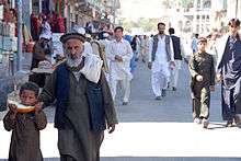
An Afghan father and his child walk down the street from the local farmers market in Asadabad (September 30, 2009).
-

Members of Kunar Provincial Reconstruction Team (PRT-Kunar) walk in the streets of Asadabad.
-

U.S. Army Staff Sgt. Michael Cruz of Cortland, New York, conducts a patrol with Afghan National Security Forces (ANSF) through the streets of Asadabad in August 2009.
References
- ↑ "Archived copy". Archived from the original on 2009-06-16. Retrieved 2009-06-16.
- ↑ https://maps.google.com/maps?ie=UTF-8&hl=en&tab=wl
- ↑ http://www.disam.dsca.mil/pubs/Indexes/Vol%2031_3/Moeller.pdf
- ↑ See the linked articles.
- ↑ Killing the Cranes, Edward Girardet, 2011, pub by Chelsea Green
- ↑ Before Taliban, Genealogies of the Afghan Jihad, David B. Edwards, University of California Press, 2002, The Regents of the University of California
- ↑ The Main Enemy, Bearden and Risen, 2004
- ↑ [books.google.com/books?id=9jw7AQAAIAAJ The Journal of the Royal Geographical Society - Volume 42 - Page 190], 1872
- ↑ Cabool: A Personal Narrative . . , by Sir Alexander Burnes, pub by John Murray, 1843, via Google Books
- ↑ See the Baburnama
- ↑ Asadabad, Encyclopedia Iranica online, Encyclopedia Iranica foundation
- ↑ Killing the Cranes, Edward Girardet
- ↑ Historical Dictionary of Afghanistan, By Ludwig W. Adamec, 2012, entry Spetsnaz, via Google Books
- ↑ http://www.salon.com/2002/09/06/asadabad/
- ↑ Urban, Mark (1988). War in Afghanistan. Houndmills, Basingstoke, Hampshire: Macmillan Press. p. 27. ISBN 978-0-333-43263-1. Urban cites The Guardian, 8 January 1979.
- ↑ Lewis, George, Fetter, Steve and Gronlund, Lisbeth (1993). Casualties and damage from Scud attacks in the 1991 Gulf War. Defense and Arms Control Studies Program, Center for International Studies, Massachusetts Institute of Technology, p. 13
- ↑ Adamec, Ludwig (2011). Historical Dictionary of Afghanistan. Scarecrow Press, p. 226.ISBN 0810878151
- ↑ http://www.army.mil/article/95890/Team_building_on_an_Afghan_mountainside/
- ↑ http://georgewbush-whitehouse.archives.gov/infocus/afghanistan/
- ↑ From Reform to Revolution, Louay Safi, Intellectual Discourse 1995, Vol. 3, No. 1 LINK and Historia, Le vent de la révolte souffle au Caire, Baudouin Eschapasse, LINK
- ↑ Karzai seeks end to war on Afghan soil
- ↑ http://complexoperations.org/cowiki/Kunar_Province
- ↑ CIA worker is jailed over beating, BBC February 13, 2007
- ↑ "Union City adds new 'sibling' to its list of sister cities", Insidebayarea.com-The Oakland Tribune/The Argus, accessed 18 August 2012
External links
| Wikimedia Commons has media related to Asadabad. |
- ASADĀBĀD - Encyclopedia Iranica
- Asadabad.ru, an entire Russian website devoted to the veterans of the 334th from the Soviet Afghan war
- Vlasenko Map i-42-12, a highly detailed old Russian map of the area
