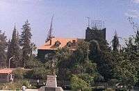
As-Suwayda
| As-Suwayda السويداء | |
|---|---|
|
The Roman amphitheatre | |
 As-Suwayda Location in Syria | |
| Coordinates: 32°42′N 36°34′E / 32.700°N 36.567°E | |
| Country |
|
| Governorate | As Suwayda Governorate |
| District | As-Suwayda District |
| Population (2004 census[1]) | |
| • City | 73,641 |
| • Metro | 138,822 |
| Time zone | EET (UTC+2) |
| • Summer (DST) | +3 (UTC) |
| Area code(s) | 16 |
As-Suwayda (Arabic: السويداء / ALA-LC: as-Suwaydā’), also spelled Sweida, is a mainly Druze city located in southwestern Syria, close to the border with Jordan.
It is the capital of As-Suwayda Governorate, one of Syria's 14 governorates, bordering Jordan in the South and the governorates of Daraa in the West and Rif Dimashq in the North and East.
Demographics and population
The inhabitants of the city are mainly Druze with a prominent Greek Orthodox Christians minority.
The population of As-Suwayda Governorate is 313,231 (2004 census).
History

The city was founded by the Nabataeans as Suada. It became known as Dionysias (Greek: Διονύσιας) in the Hellenistic and Roman times, for Dionysus the god of wine - the city is situated in a famous ancient wine-producing region.
The name Dionysias replaced the former Nabatean name of Suada in 149 AD after the Nabataean influence decreased and then concentrated towards the south, as a result of the accelerating Hellenization of Coele-Syria at that time.
Dionysias was a part of the Roman province of Arabia Petraea, and received the rights of civitas under the reign of Commodus between 180–185.
Dionysus was worshipped in the same Nabatean temple dedicated for Dushara. This practice of associating the worship of local and Hellenic gods was common in Hellenistic Syria.
This name remained in use during the Byzantine period, when the town was under the influence of Ghassanids, Dionysias then was a Diocese as a suffragan of Bosra. It was mentioned in the Synecdemus of Hierocles. After the Arab conquests it became a titular see.[2]
Yaqut al-Hamawi noted in the 1220s that As Suwaida was "a village of the Hauran Province".[3]
In recent times Dionysias was firstly identified as Sweida by William Henry Waddington.

Archaeology
Many archeological sites could be found in the old part of the city:
- Temple of Dionysus-Dushara: eight well-decorated columns are still standing from the temple.
- Saint Sergius Basilica: was built in the fifth century A.D. It has Byzantine architecture elements, with an abbey surrounding it. The basilica was dedicated to Saint Sergius.

- The arch of the lesser church: the church itself is ruined. An arch is still standing there known locally as Al Mashnaqa (English: The Gallow) with grape motif decorations.
- The amphitheatre: was recently discovered, south of the Agora.
The city has many ancient reservoirs, towers and old Roman houses that are still inhabited by locals.
Many parts of the old city are still to be excavated like the Roman aqueduct, a conical reservoir, and a larger Roman amphitheatre.
Climate
| Climate data for As-Suwayda | |||||||||||||
|---|---|---|---|---|---|---|---|---|---|---|---|---|---|
| Month | Jan | Feb | Mar | Apr | May | Jun | Jul | Aug | Sep | Oct | Nov | Dec | Year |
| Average high °C (°F) | 10.5 (50.9) |
11.7 (53.1) |
15.2 (59.4) |
20.1 (68.2) |
25.4 (77.7) |
29.2 (84.6) |
30.1 (86.2) |
30.9 (87.6) |
29.2 (84.6) |
26.0 (78.8) |
19.1 (66.4) |
12.8 (55) |
21.68 (71.04) |
| Average low °C (°F) | 1.9 (35.4) |
2.6 (36.7) |
4.8 (40.6) |
7.8 (46) |
11.3 (52.3) |
14.2 (57.6) |
15.6 (60.1) |
16.1 (61) |
14.4 (57.9) |
11.8 (53.2) |
8.1 (46.6) |
3.9 (39) |
9.38 (48.87) |
| Average precipitation mm (inches) | 69 (2.72) |
71 (2.8) |
57 (2.24) |
21 (0.83) |
8 (0.31) |
0 (0) |
0 (0) |
0 (0) |
1 (0.04) |
11 (0.43) |
27 (1.06) |
58 (2.28) |
323 (12.71) |
| Source: Climate-Data.org | |||||||||||||
References
- ↑ http://www.cbssyr.org/new%20web%20site/General_census/census_2004/NH/TAB13-1-2004.htm
- ↑ "Catholic Encyclopedia: Dionysias". Newadvent.org. 1909-05-01. Retrieved 2014-06-20.
- ↑ quoted in le Strange, 1890, p. 540
- ↑ "Climate: As Suwayda". Retrieved 2016-02-27.
Bibliography
| Wikimedia Commons has media related to As-Suwayda. |
- Strange, le, Guy (1890). Palestine Under the Moslems: A Description of Syria and the Holy Land from A.D. 650 to 1500. Committee of the Palestine Exploration Fund.
External links
- Map of the town, Google Maps
Coordinates: 32°42′0″N 36°34′0″E / 32.70000°N 36.56667°E

