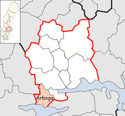
Arboga Municipality
| Arboga Municipality Arboga kommun | ||
|---|---|---|
| Municipality | ||
| ||
 | ||
| Country | Sweden | |
| County | Västmanland County | |
| Seat | Arboga | |
| Area[1] | ||
| • Total | 419.37 km2 (161.92 sq mi) | |
| • Land | 325.43 km2 (125.65 sq mi) | |
| • Water | 93.94 km2 (36.27 sq mi) | |
| Area as of January 1, 2014. | ||
| Population (June 30, 2016)[2] | ||
| • Total | 13,843 | |
| • Density | 33/km2 (85/sq mi) | |
| Time zone | CET (UTC+1) | |
| • Summer (DST) | CEST (UTC+2) | |
| ISO 3166 code | SE | |
| Province | Västmanland and Närke | |
| Municipal code | 1984 | |
| Website | www.arboga.se | |
Arboga Municipality (Arboga kommun) is a municipality in Västmanland County in central Sweden. Its seat is located in the city of Arboga.
In 1971 the City of Arboga was amalgamated with a part of the rural municipality Medåker, forming a municipality of unitary type. In 1974 the parish Götlanda was added from the dissolved Glanshammar municipality and transferred from Örebro County.
Localities
- Arboga (seat)
- Götlunda
- Medåker
- Värhulta
- Kvarnsjön
Politics
Result of the 2010 election
Moderate Party 26,37%
Centre Party 5,79%
Liberal People's Party 6,80%
Christian Democrats 4,52%
Swedish Social Democratic Party 37,57%
Left Party 5,69%
Green Party 6,25%
Sweden Democrats 5,98%
Other Parties 1,04%
References
- ↑ "Statistiska centralbyrån, Kommunarealer den 1 januari 2014" (Microsoft Excel) (in Swedish). Statistics Sweden. Retrieved 2014-04-18.
- ↑ "Folkmängd i riket, län och kommuner 30 juni 2016" (in Swedish). Statistics Sweden. August 17, 2016. Retrieved August 17, 2016.
External links
| Wikimedia Commons has media related to Arboga Municipality. |
- Arboga Municipality – Official site
- Arboga -Bilingual site
Coordinates: 59°24′N 15°50′E / 59.400°N 15.833°E
This article is issued from Wikipedia - version of the 6/2/2014. The text is available under the Creative Commons Attribution/Share Alike but additional terms may apply for the media files.
