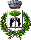
Andorno Micca
| Andorno Micca | ||
|---|---|---|
| Comune | ||
| Comune di Andorno Micca | ||
|
| ||
| ||
 Andorno Micca Location of Andorno Micca in Italy | ||
| Coordinates: 45°36′N 8°3′E / 45.600°N 8.050°E | ||
| Country | Italy | |
| Region | Piedmont | |
| Province / Metropolitan city | Biella (BI) | |
| Frazioni | Cerruti, Colma, Locato Inferiore, Locato Superiore, Lorazzo Inferiore, Lorazzo Superiore, Ravizza, San Giuseppe di Casto | |
| Government | ||
| • Mayor | Stefano Aldrisi | |
| Area | ||
| • Total | 12.1 km2 (4.7 sq mi) | |
| Elevation | 544 m (1,785 ft) | |
| Population (31 October 2008[1]) | ||
| • Total | 3,498 | |
| • Density | 290/km2 (750/sq mi) | |
| Demonym(s) | Andornesi | |
| Time zone | CET (UTC+1) | |
| • Summer (DST) | CEST (UTC+2) | |
| Postal code | 13061 | |
| Dialing code | 015 | |
| Website | Official website | |
Andorno Micca is a comune (municipality) in the Province of Biella in the Italian region Piedmont, located about 70 kilometres (43 mi) northeast of Turin and about 4 kilometres (2 mi) northwest of Biella.
Overview
It is located in the Valle Cervo, at the feet of the Biellese Prealps.
The comune takes its second name from Pietro Micca, a hero of the siege of Turin against the French (1706).
The Sacro Monte di Andorno is named after this village, despite it is not in the comune territory.
See also
References
External links
![]() Media related to Andorno Micca at Wikimedia Commons
Media related to Andorno Micca at Wikimedia Commons
This article is issued from Wikipedia - version of the 10/12/2016. The text is available under the Creative Commons Attribution/Share Alike but additional terms may apply for the media files.
