Alpes Cottiae
| Provincia Alpes Cottiae | |||||
| Province of the Roman Empire | |||||
| |||||
 | |||||
| Capital | Segusio | ||||
| Historical era | Antiquity | ||||
| • | Created by Augustus | 15 BC | |||
| • | Deposition of Romulus Augustulus | 476 AD | |||
| Today part of | | ||||
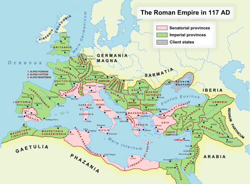
Alpes Cottiae [alˈpeːs ˈkɔt.tjae̯] was a province of the Roman Empire, one of three small provinces straddling the Alps between modern France and Italy.[1] Its name survives in the modern Cottian Alps. In antiquity, the province's most important duty was the safeguarding of communications over the Alpine passes.
Alpes Cottiae was bordered by Gallia Narbonensis to the west, Alpes Maritimae to the south, Italia to the east, and Alpes Graiae to the north. The provincial capital was at Segusio (modern Susa in Piedmont).
History
The province had its origin in the kingdom controlled by Donnus, ruler of the local Ligurian tribes of the area in the middle of the 1st century BC, and was named after his son and successor Cottius, whose realm was integrated into the Roman imperial system under Augustus.
Initially, Cottius and his own son of the same name after him continued to hold power as client kings; afterwards, under Nero a procurator was appointed and it officially became a Roman province. The governors of the province were prefects from the Equestrian order.
Settlements in Alpes Cottiae included:
- Ad Fines (Malano) ("mansio", customs post)
- Ocelum (Celle) ("oppidum", Celtic village)
- Ad Duodecimum (S. Didier) ("mutatio")
- Segusio (Susa) (capital)
- Venausio (Venaus)(oppidum)
- Excingomago (Exilles) (oppidum,possible Donno's capital)
- Caesao / Goesao (Cesana Torinese)("castrum")
- Ad Martes Ultor (late imperial "Ulcense") (Oulx) ("castrum")
- Brigantium (Briançon) (mansio)
- Mons Matronae (Mont Genèvre)
See also
References
- ↑ Bertrand, E.; R. Talbert; S. Gillies; T. Elliott; J. Becker. "Places: 167636 (Alpes Cottiae)". Pleiades. Retrieved November 1, 2014.
- Tilmann Bechert: Die Provinzen des römischen Reiches: Einführung und Überblick. von Zabern, Mainz 1999.
- Bartolomasi : Valsusa Antica . Alzani, 1975.
- Prieur - La province romaine des Alpes Cottiennes, Lyon 1968.
Coordinates: 45°01′00″N 6°47′03″E / 45.0167°N 6.7841°E
