Abu Musa Airport
| Abu Musa Airport Abumusa Airport | |||||||||||
|---|---|---|---|---|---|---|---|---|---|---|---|
| IATA: AEU – ICAO: OIBA | |||||||||||
| Summary | |||||||||||
| Airport type | Public | ||||||||||
| Location | Abu Musa Island, Iran | ||||||||||
| Elevation AMSL | 23 ft / 7 m | ||||||||||
| Coordinates | 25°52′32″N 055°01′58″E / 25.87556°N 55.03278°ECoordinates: 25°52′32″N 055°01′58″E / 25.87556°N 55.03278°E | ||||||||||
| Map | |||||||||||
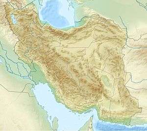 OIBA Location of airport in Iran | |||||||||||
| Runways | |||||||||||
| |||||||||||
Abu Musa Airport or Abumusa Airport (IATA: AEU[3], ICAO: OIBA) is an airport serving Abu Musa Island,[1] in the Hormozgan Province in Iran.
Facilities
The airport resides at an elevation of 23 feet (7 m) above mean sea level. It has one runway designated 08/26 with an asphalt surface measuring 2,986 by 45 metres (9,797 ft × 148 ft).[1]
References
- 1 2 3 Airport information for OIBA from DAFIF (effective October 2006)
- ↑ Airport information for AEU at Great Circle Mapper. Source: DAFIF (effective October 2006).
- ↑ "Airline and Airport Code Search (AEU: Abu Musa Island)". International Air Transport Association (IATA). Retrieved 1 October 2012.
External links
This article is issued from Wikipedia - version of the 11/8/2016. The text is available under the Creative Commons Attribution/Share Alike but additional terms may apply for the media files.